

PURPOSE
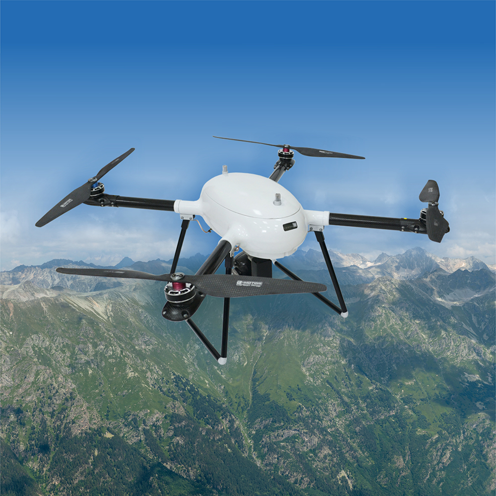
SKYRON O UAV based surrounding area control system is designed for operational surveillance and video recording of emergency locations (or their probability assessment), intruder detection, search for missing persons, also under restricted access conditions.
FIELDS OF APPLICATION
- search and reconnaissance agencies
- as part of integrated facility security systems
VERSION
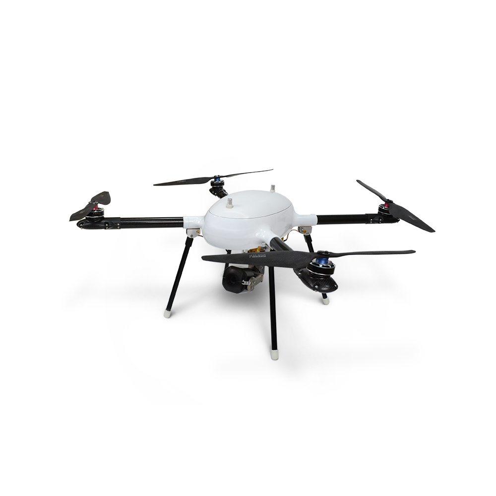
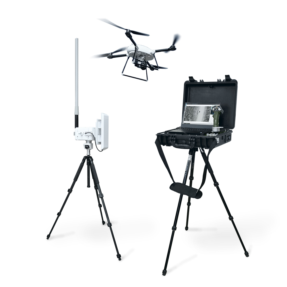
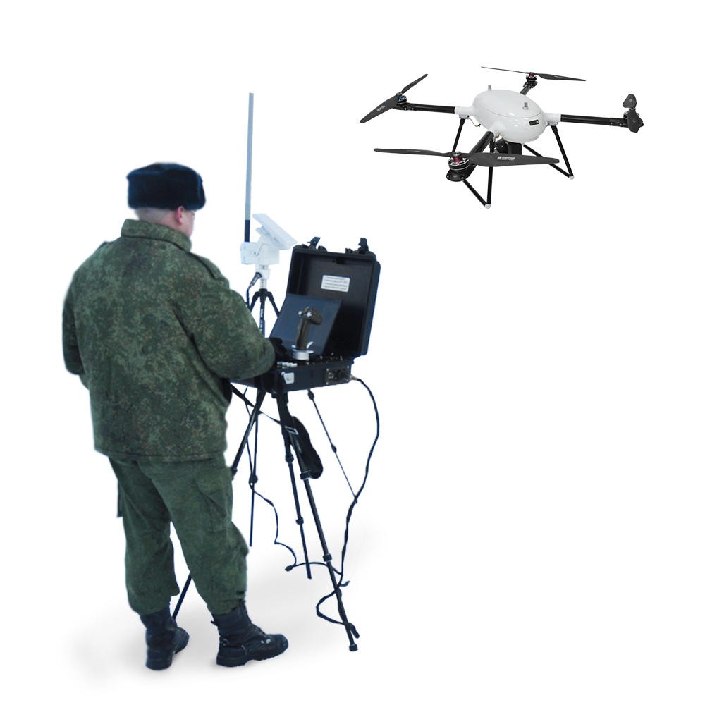
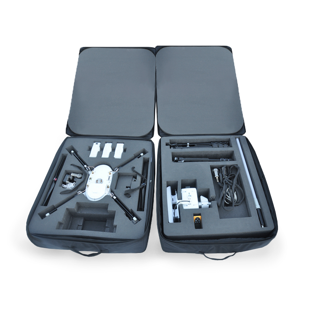
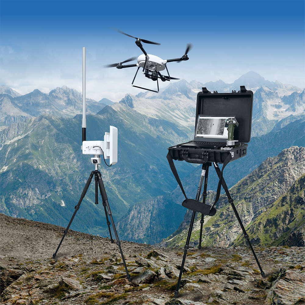
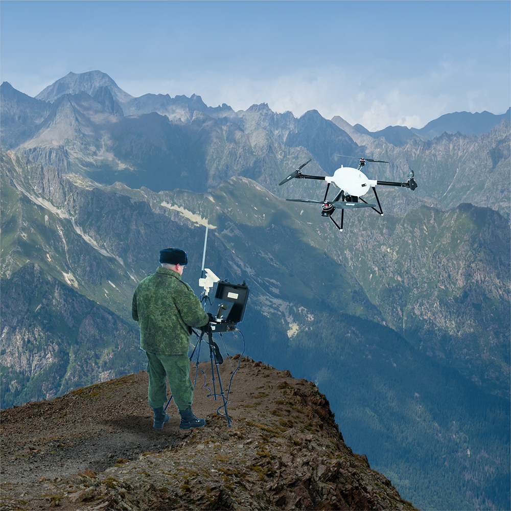
- system consists of an unmanned aerial vehicle (UAV) equipped with a removable payload, a launch container, an antenna module with PTZ unit and ground control station (GCS)
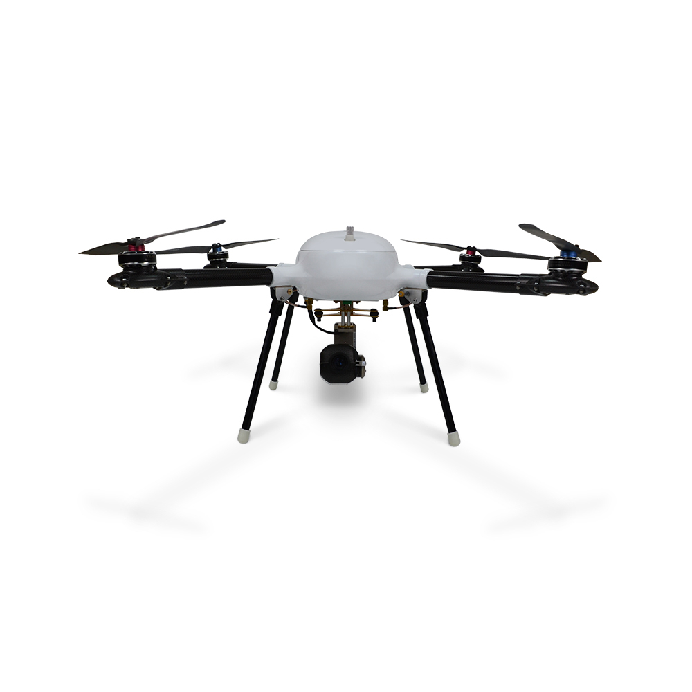
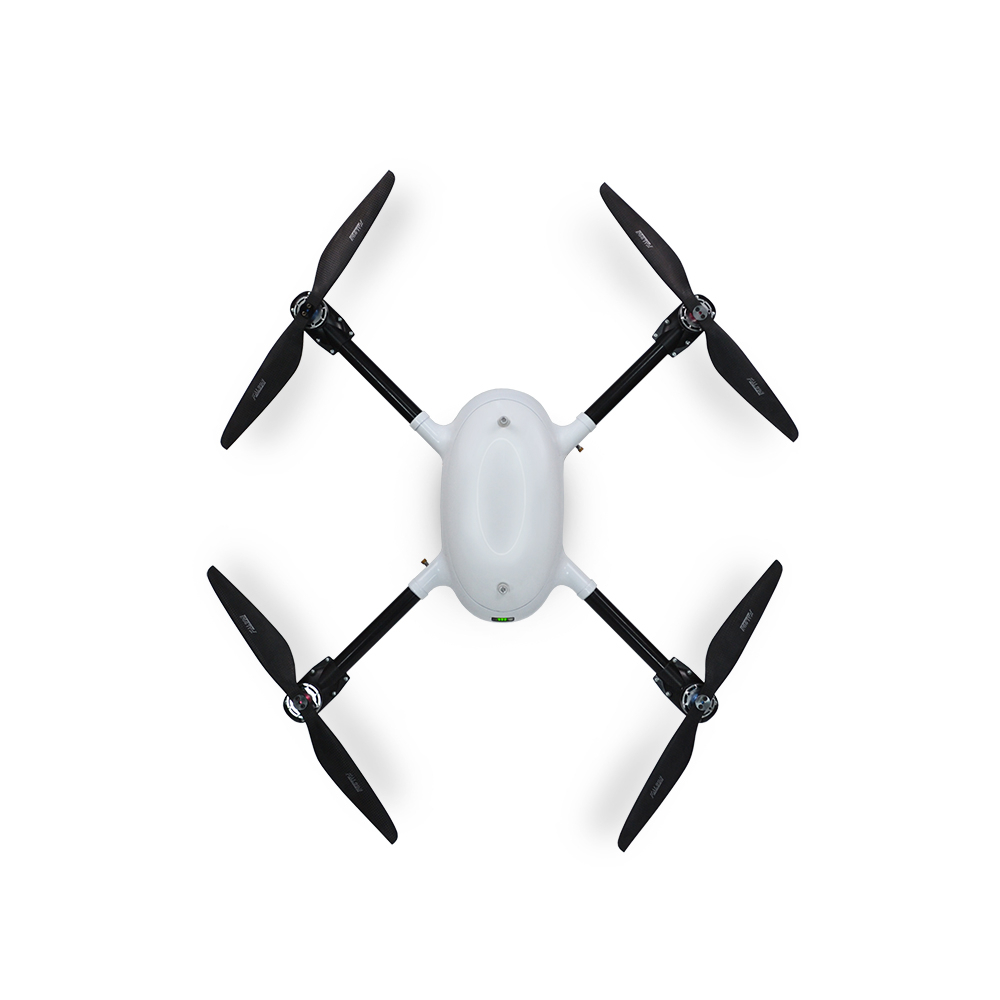
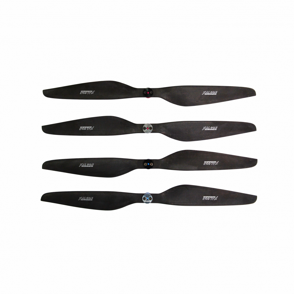
- UAV is an undismountable quadcopter with four lift rotors and detachable power supply modules
- quadcopter is equipped with electric brushless motors with direct drive to the propellers
- removable UAV payload is a video camera on a gyrostabilized platform (included into standard delivery set) or a thermal imaging camera on a gyrostabilized platform (specified in the delivery contract) mounted on a quick release lock on UAV bottom part
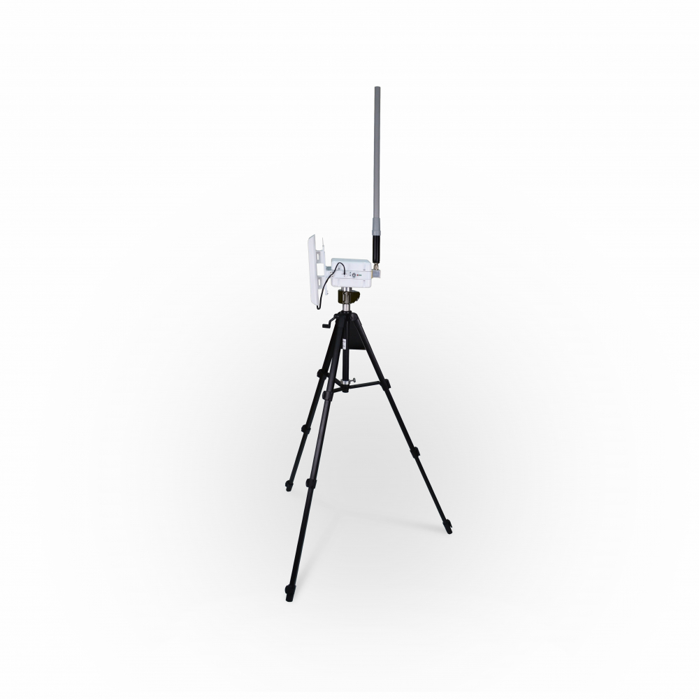
- antenna module with pan/tilt unit mounts on the tripod included in the package
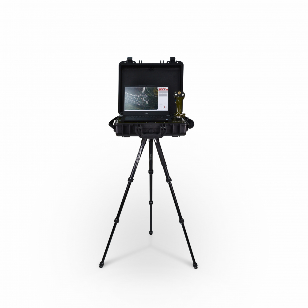
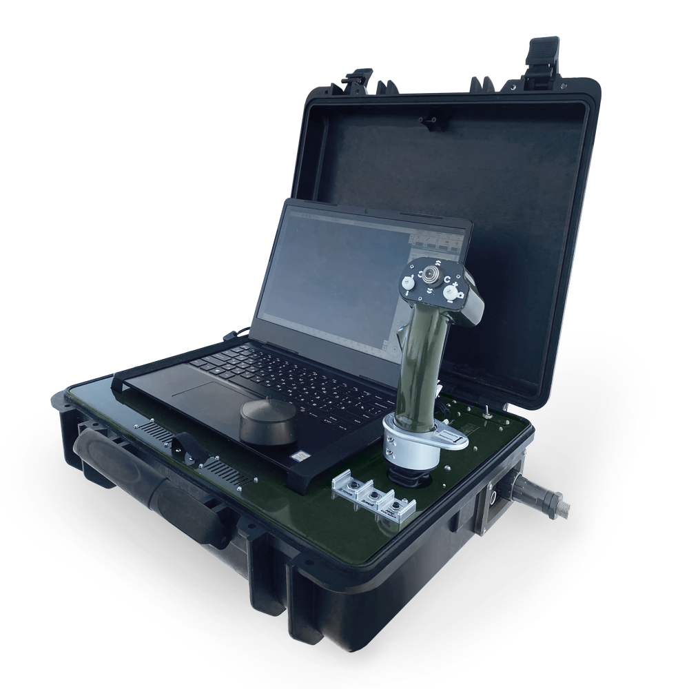
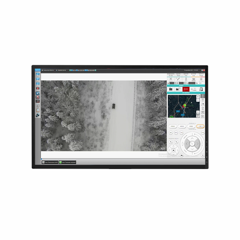
- GCS includes a notebook with special software, a mouse, a joystick controller in a protective case
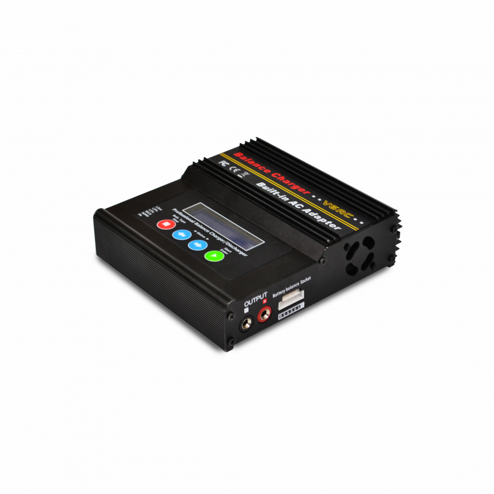
- system is equipped with a charging unit to recharge the power supply module from a single-phase AC grid
- additional unit for simultaneous charging of four power supply modules from single-phase AC grid is optional (specified in the delivery contract)
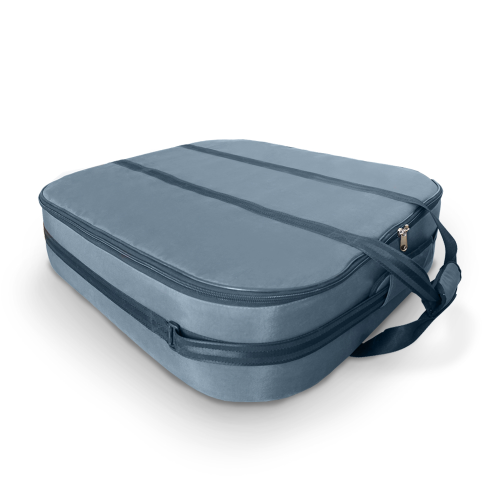
- special case is included for transporting and protecting all components from external impacts included in the set
FEATURES
- video surveillance, thermal imaging surveillance and data transfer to ground control station
- receiving, viewing and recording real-time video feed from the UAV at ground control station
- flight control of UAV and its payload - video camera or thermal imaging camera - from ground control station
- creating, editing, saving of flight maps
- flight plan creating, editing, saving on the notebook and uploading it to UAV
- display of UAV telemetry data and its position on the flight map
- flying according to pre-set flight plan: upon launching UAV follows a predefined route consisting of navigation points with preset altitude and time of stay parameters
- flight without a pre-set map according to automatically generated flight plan: upon launching UA performs a 10 m take-off, the operator can control the flight using GCS manipulator
- creating flight plans on location map including up to 200 waypoints with specified location coordinates, altitude and time of stay
- speed and altitude adjustment by the operator during flight to a waypoint
- operator changing the aircraft heading angle during flight to the waypoint maintaining the flight path
- UAV control upon reaching a navigation point, its offset, turn, altitude, video camera tilt, prolonging stay time in the navigation point and leaving it before the preset stay time ends
- Operator interrupts the flight at any time with a return command, at that UAV will stop, continue to fly to the landing point and perform an automatic landing
- automatic flight plan interruption and returning to landing point in case of communication failure with GCS for more than 12 seconds
- forced flight plan interruption at power module voltage drop and depending on the charge level, returning to the launch point or landing at the current position
- pan-tilt unit tracking elevation and direction angle to UAV during the flight
PECULIARITIES
- downloading via Internet and saving terrain maps to the GCS notebook both preliminarily for the selected area and directly at the deployment site with current coordinates reference
- automatically generated flight plan mode to reduce launch preparation period and perform flights in the absence of a flight map for surveying incident sites, inspecting facilities, etc.
- automatic synchronization of data transmission between UAV and antenna module with pan/tilt unit
- product assembly time from travelling position to operating one takes up to 5 minutes for one person
- system operates with SKYRON special software
SCOPE OF SUPPLY
Name |
Quantity |
UAV SKYRON O STVF.424358.013 |
1 шт. |
Antenna module with pan-tilt unit STVF.425664.021 |
1 шт. |
Ground control station STVF.426219.003 |
1 шт. |
Power supply module STVF.435351.001-01 |
3 шт. |
PN-AB2-VK2-10 Video camera on gyrostabilized platform ПН-АБ2-ВК2-10 STVF.426459.181 |
1 шт. |
PN-AB2-T1 Thermal imaging camera on gyrostabilized platform STVF.426459.185 |
* |
PN-AB2-VK5-T1 Gyrostabilized video camera-thermal camera bracket STVF.426459.208 |
* |
Transportation case STVF.305643.063-01 |
1 шт. |
STS-22204 Charging unit STVF.436112.013 |
1 шт. |
Voltage converter DIGMA DCI-1000 |
1 шт. |
MEGEON multifunction anemometer 11990 |
1 шт. |
STS-22202 Charging unit STVF.431429.003 |
* |
UAV repair set STVF.424921.118 |
* |
Packaging STVF.305633.057 |
1 шт. |
Spare parts set-O STVF.425973.216 |
1 к-т |
Operational documents list STVF.424252.127VE |
1 экз. |
Formulary STVF.424252.127FO |
1 экз. |
Примечания: 1 – The number of parts of the system marked with «*» is specified in the delivery contract 2 – Operational design documentation contents are determined in accordance with the operational documents list STVF.424252.127VE |
|
DESCRIPTION OF SYSTEM PARTS
- SKYRON O Unmanned aerial vehicle is designed for air transporting a video camera or a thermal imaging camera to the monitored area
- UAV-mounted PN-AB2-VK2-10 Video camera on gyrostabilized platform is designed to gather video feed from the monitored terrain section and transmit it to the ground control station.
- UAV-mounted PN-AB2-T1 Thermal imaging camera on a gyrostabilized platform is designed to receive video feed from the monitored area under low-light conditions and transmit it to the ground control station
- UAV-mounted PN-AB2-VK5-T1 gyrostabilised video camera-thermal imager suspension is designed to receive video feed from the monitored terrain section at any illumination level and transmit them to the ground control station
- antenna module with pan/tilt unit is designed to extend the effective UAV range, provide a wireless communication link between the UAV and the ground control station, and to direct the antenna towards the UAV by azimuth and elevation angle during flight
- ground control station is designed to operate the SKYRON O unmanned aerial vehicle and the entire system
- detachable power supply modules are designed to supply power to UAV and ensure its operability
- STS-22204 charging unit is designed to recharge one power supply module from single-phase 220 V AC grid with 50 Hz frequency
- STS-22202 charging unit is designed to simultaneously recharge four power supply modules from single-phase 220 V AC grid with 50 Hz frequency
DESCRIPTION OF SYSTEM SOFTWARE
Included in ground control station, the notebook with pre-installed SKYRON software enables system control, flight plan creating and editing, indication of emergency situations, displaying UAV location marker on the map with attributes, direct UAV control, reception and processing of telemetry data, reception and transmission of UAV video feed, video/thermal imaging camera control, indication of the broadband access module pan-tilt unit parameters.
RELIABILITY AND WARRANTY
- Warranty operating period - 2 years.
- Assigned operating period - 7 years.
Parameter name |
Value |
Effective application height, m |
20–300 |
Flight speed: - km/h - m/s |
from 0 to 54 from 0 to 15 |
Decelerating flight, m/s (maximum) |
1 |
Maximum takeoff point altitude above sea level, meters |
2700 |
Operating radius, m (maximum) |
5500 |
Maximum wind velocity with ensured UAV operation, m/s |
10 |
En-route maximum wind gusts, m/s |
14 |
Maximum vertical speed, m/s - ascending - descending |
5 2,5 |
Maximum flight time at sea level under standard conditions*, minutes |
40 |
Single-person launch preparation time, minutes (maximum) |
10 |
Control over closed encrypted digital radio channel: - frequency, MHz - range, km (maximum) |
868 6 |
Holding filming position / Flight along preset route using positioning signals |
Glonass/GPS |
Auto return at battery voltage drop |
Yes |
Flight plan interruption by operator's command with UAV manual control option |
Yes |
Video camera resolution, Mp |
2 |
Focal length, mm |
5–50 |
Video camera stabilization level: - in dynamic state, deg. (rad.) - in static state, deg. (rad) |
0,1 (0,0017) 0,01 (1,74) |
Video camera's field resolution with maximum magnification at 500-meter range, m |
0,4 |
Video camera vertical tilt angle, deg. |
+30 … –100 |
Thermal imaging camera maximum resolution, pix |
384х288 |
Focal length of thermal imaging camera lens, mm |
17 |
Thermal imaging camera stabilization level: - in dynamic state, deg. (rad.) - in static state, deg. (rad) |
0,2 (0,0034) 0,011 (1,9) |
Thermal imaging camera's field resolution with maximum magnification at 500-meter range, m |
1 |
Thermal imaging camera vertical tilt angle, deg. |
+30 … –100 |
Payload platform stabilization |
Tilt/Tang/Course |
Video camera /thermal imager DC power supply voltage, V |
12±10% |
Video camera /thermal imager current consumption, A |
1±10% |
Operating temperature range, °С** |
from -25 to +50 |
UAV with video camera take-off weight, kg (maximum) |
4,2 |
System overall weight, kg (maximum) |
45 |
UAV overall dimensions in parking position (without propellers), mm (maximum) |
600х600х320 |
*Standard conditions: standard pressure 760 mmHg, wind speed 3 m/s (max), temperature from 0°С and above. **If UAV stored at positive temperature for two hours before the start. |
|
